CheckPoint
Unified Project Data & Reporting
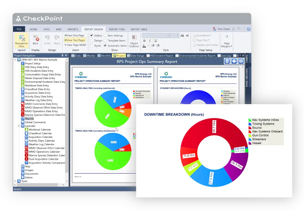
CheckPoint is an advanced reporting and management system for Client Representatives, Contractors, Exploration Managers and Project Managers.
CheckPoint is an advanced reporting and management system for Client Representatives, Contractors, Exploration Managers and Project Managers.

Provides meaningful insight to Client Representatives, Project Managers, Contractors and Operations Geophysicists.

to a fully extensible database combined with powerful reporting tools. Fully scalable architecture and cloud enabled synchronisation ensures CheckPoint can meet the demands of any operation.

Microsoft Azure enabled synchronisation permits multiple users in a single location, or multiple users at multiple locations to connect to a central database.

Including Towed Streamer Seismic (2D, 3D, 4D), Seabed Seismic (OBC, OBN), Land and TZ Seismic, Site and Geotechnical Surveys.

Operational Dynamics, Time Accounting, Event Entry.

Production Accounting, Shot Tables, Custom QC Fields, QC Summary Tables.


P111 Import, STS Import, SBS Import, Custom CSV Import, Geometis Import, Immediate Data Analysis.

MMO Comments, MMO Observer Efforts, Marine Species Detection, Fisheries Observer Effort...
Read Article